Teno Alto - Teno Bajo
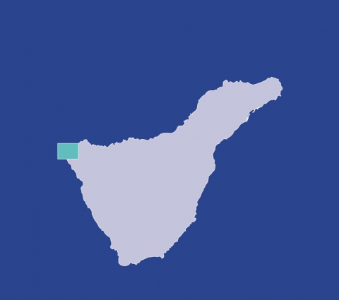
The track starts in the hamlet of Teno Alto 1, in a place known as Los Bailaderos, in the present path leading to "Las Cuevas" (caves) and passing south of El Vallado Mountain. In this first part of the track one cannot but admire the popular architecture, as well as old tile-ovens and "tagoros" (old meeting point of the idigenous peoples). Once in Las Cuevas, you keep going down to Las Casas through a most irregular terrain, where at times you may still see the original cobblestones. Las Casas lies at the foot of the slopes of Barranco de Las Casas, at the beginning of the Teno peninsula. There are interesting remains of the Canarian traditional architecture. From this point you go straight to Punta de Teno 2, on the extreme north-west of the island, in the middle of the Natural Park of Teno and where you get dramatic views of the peninsula, coast and the lighthouse of Teno.
Interesting details
Buenavista del Norte

Flora
Laurel forests.
Values
Teno Massif. The hamlets of Masca and El Palmar. Monte del Agua, next to the hamlet of El Palmar. Geological interest Teno mountainous massif which together with the Anaga massif made the formation of the island of Tenerife possible about seven million years ago.
Heritage
The Church of Nuestra Sra. de los Remedios. (18th century). Mudejar elements (art style with Arab influences). Religious art museum.
Protection
Rural Park of the Teno Massif. Useful telephone numbers Town Tourist Information Centre 922 860 348 Buenavista Local Police 922 127 175 Red Cross 922 281 800 City/Highway Police 922 840 255 TITSA (Bus company) 922 531 300
Route details
| Position | Borough of Buenavista del Norte |
|---|---|
| Start point | Los Bailaderos (Teno Alto) |
| End point | Punta de Teno |
| Distance | 4,2 Km. approx. |
| Duration | 2 h. |
| Difficulty | Medium |
| Accessibility | TITSA bus routes |


