Tamaide
The track starts at the crossing of El Lomo, General Franco Street (1 on the map), with the Camino del Pilón on the left. This path still shows some of its original cobblestones and goes between stone walls and abandoned terraced fields which have been invaded by Paris daisies, sweet and sour spurges, lavender... You go on until you get to Barranco del Lomo. You cross it and start admiring beautiful views of the coastline of San Miguel, Granadilla and Arona, as well as the natural site of Roque de Jama. You keep going for about 300 m.; at this point the track forks in two. You go to the right towards Barranco Drago. Cross it through its spurges and balos. Three important springs are to be found here: El Lunchón, La Hoya and Tamaide. As you approach the hamlet of La Hoya, you get into a farming area, its terraced fields covered with a sand-based material called "jable" to retain humidity. You cross the paved road El Roque-Aldea Blanca and come back to the track well into the hamlet of La Hoya where you may see a very interesting tile furnace and traditional architecture. Finally, as you leave La Hoya, you come to Barranco Mantible and head to La Centinela mountain, through a typical local vegetation until you get to view point of La Centinela (2 on the map), right on the boundary between the municipalities of San Miguel and Arona, on the side of the TF-28(km. 84 point), from where there is a dramatic view of the coast.
Interesting details
San Miguel de Abona.

Flora
All sorts of indigenous species, e.g.Paris daisies, sweet and sour spurges, candle plants, balos (Plocama pendula).
Values
The Ravines of El Lomo, Drago, Mantible. Springs of El Lunchón, La Hoya, Tamaide. Montaña La Centinela (Sentry Mountain)
Heritage
Tile furnace (late 19th century). Traditional houses.
Protection
Useful telephone numbers EMERGENCIES 112 San Miguel Tourist Information Centre 922 167 791 San Miguel Local Police 922 700 807 Civil Protection 922 700 861 Red Cross 922 700 348 Guardia Civil Granadilla 922 770 110 TITSA (Bus company) 922 531 300
Route details
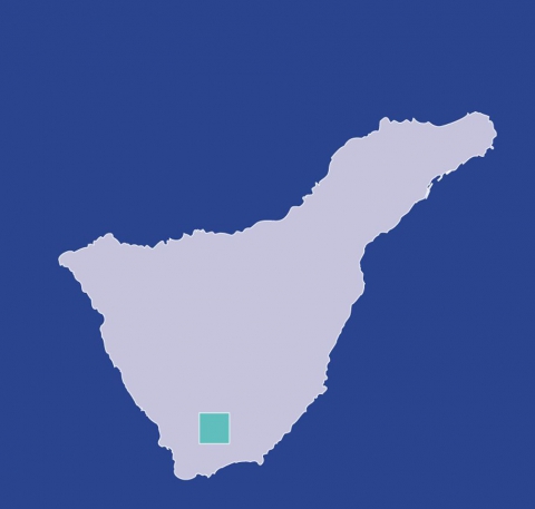
| Position | Borough of San Miguel |
|---|---|
| Start point | Tamaide |
| End point | Mirador de La Centinela |
| Distance | 4 Km. approx. |
| Duration | 1 h. 45 min. mound - 1 h. 30 min. Trip |
| Difficulty | Low |
| Accessibility | TITSA bus routes |
| Grade | 3% approx. |
| Slope | 115 mts. approx. |


